Updated
How to use the 3D map of Thailand's rivers
The map shows some 15,000 connected stretches of river following their real direction of flow, with 79 named rivers, more than 1,800 canals, 46 dams and water levels from over 800 telemetry stations.
Open the map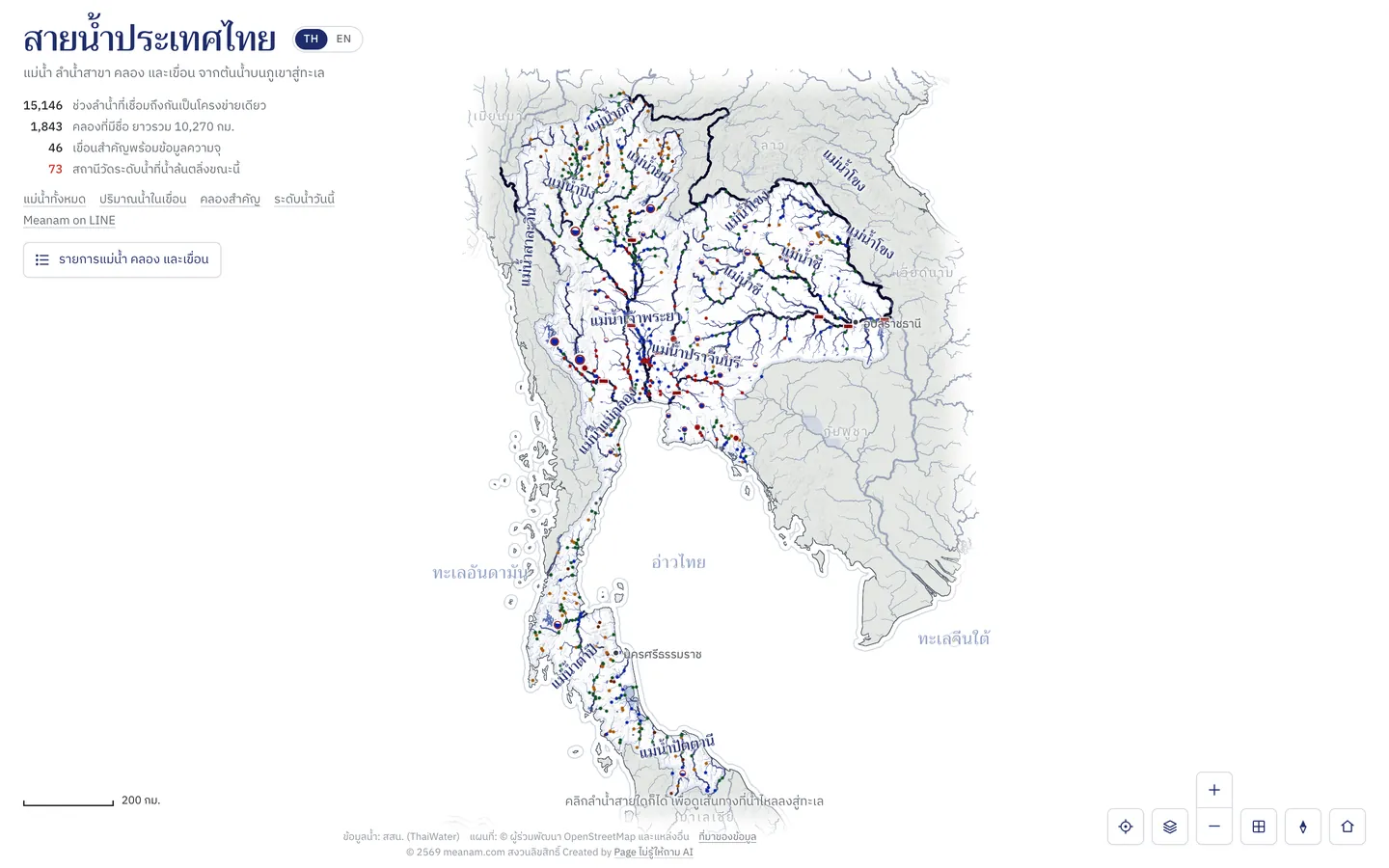
How to use it
Pan, zoom and turn
Drag to pan, scroll or pinch to zoom. The side buttons zoom, face north, tilt the view and return to the whole country.
Click a river
Click anywhere on a river: its way to the sea lights up, with every stream that joins before that point. The panel gives the distance to the sea and the catchment area.
Follow the water to the sea
Press follow the water in the panel and the camera flies with the water from the source, a dam or your point all the way to the sea.
Search the list
Type a river, canal, dam or province in the search box, or browse the list grouped by basin.
Choose layers
The layers button turns tributaries, canals, dams, reservoirs, water levels and rain on or off, and colours rivers by size or by basin.
Good to know
- Station colours
- Dots on the rivers are gauging stations: red over the bank, blue high, green normal, amber low and brown critically low.
- Line width
- Thicker lines are larger rivers with bigger catchments; the moving glints show the real direction of flow.
Where the data comes from
The river network is from HydroRIVERS and OpenStreetMap, terrain from AWS Terrain Tiles, and water levels and dams from the National Hydroinformatics Data Center (ThaiWater).
Frequently asked questions
- Does it work on phones?
- Yes, in a phone browser. The first visit loads about 6 MB of map data.
- Why do some river lengths differ from official figures?
- Lengths are measured along the rivers as drawn, which can differ from figures measured at other scales.