Updated
Tides today in Thailand: high and low water at 28 coastal stations
At the end of the rains, the sea coming up high just as the water from the north arrives holds the rivers back near their mouths and raises them. This layer puts the tide tables of 28 stations around the coast on the map: today's high and low waters, and the days the sea will come up highest in the next two weeks.
See the tides at Bangkok Port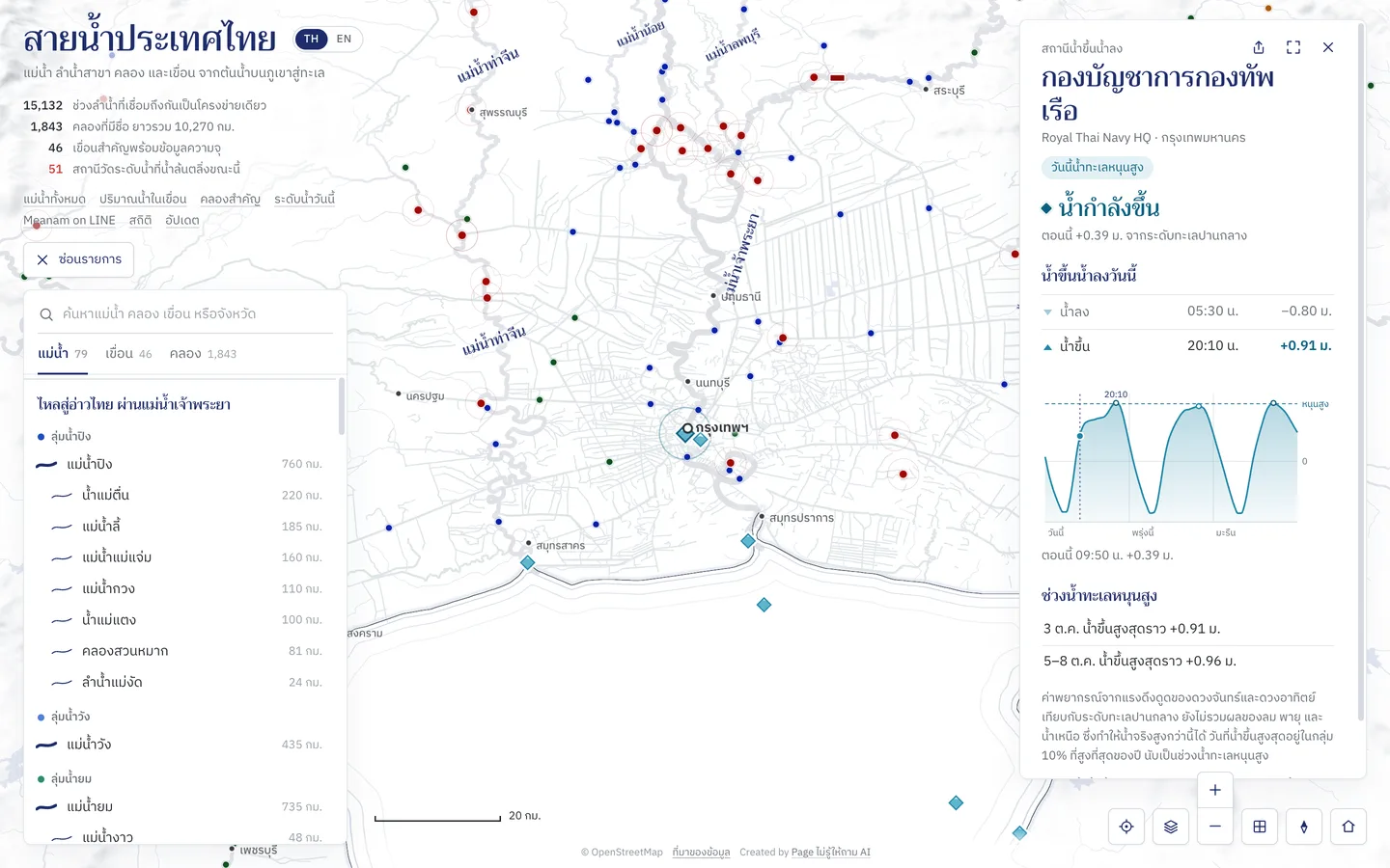
How to use it
Open a tide station
Tide stations are the sea-blue diamonds along the coast, filled to where the tide stands now. Tap one to open its panel; switch the layer on or off under Tides in the map's layers.
Read today's tides
The panel says whether the tide is rising or falling now, and lists today's high and low waters with their heights; the ones already past are faded.
Read the three days
The chart runs from midnight today to the day after tomorrow. The dashed line is the high-tide mark, and the water above it is darker. Tap or move along the chart to read any hour.
High-tide days, and places near the sea
Under the chart are the high-tide days in the next two weeks. Gauging stations and spots on the rivers within 30 km of a tide station show the next high water there.
Good to know
- Heights
- Metres from the station's mean sea level, above or below. Read them for the timing and how high the tide comes, not against the river gauges' heights, which use another datum.
- High-tide days
- Days whose high water is among the highest tenth of the year at that station. On those days the station ripples on the map and its panel says High tides today.
- Bangkok and the river mouths
- A high sea pushes the Chao Phraya, Tha Chin, Mae Klong and Bang Pakong up as far as the cities. When it comes with a lot of water from the north, the rivers run higher than usual.
Where the data comes from
Hourly tide tables from the Hydro-Informatics Institute (HII), the same the National Hydroinformatics Data Center (ThaiWater) uses.
Frequently asked questions
- What is a high tide here?
- The sea coming up high enough to hold back the rivers near their mouths, so they rise. In the upper Gulf of Thailand the sea is highest from about October to February, which overlaps with the water coming down from the north.
- How often are there high-tide days?
- About 36 days a year at each station, usually two to four days at a time once or twice a month, and more of them late in the year when the sea is seasonally high.
- Why can the sea be higher than predicted?
- The tables are the pull of the moon and the sun alone. Onshore wind, storms and a lot of water coming down the rivers can raise it higher, so follow local announcements as well.