What's new
New features and improvements on the Rivers of Thailand map, with how to use them, newest first.
Rain on the map, over 24 hours and the last hour
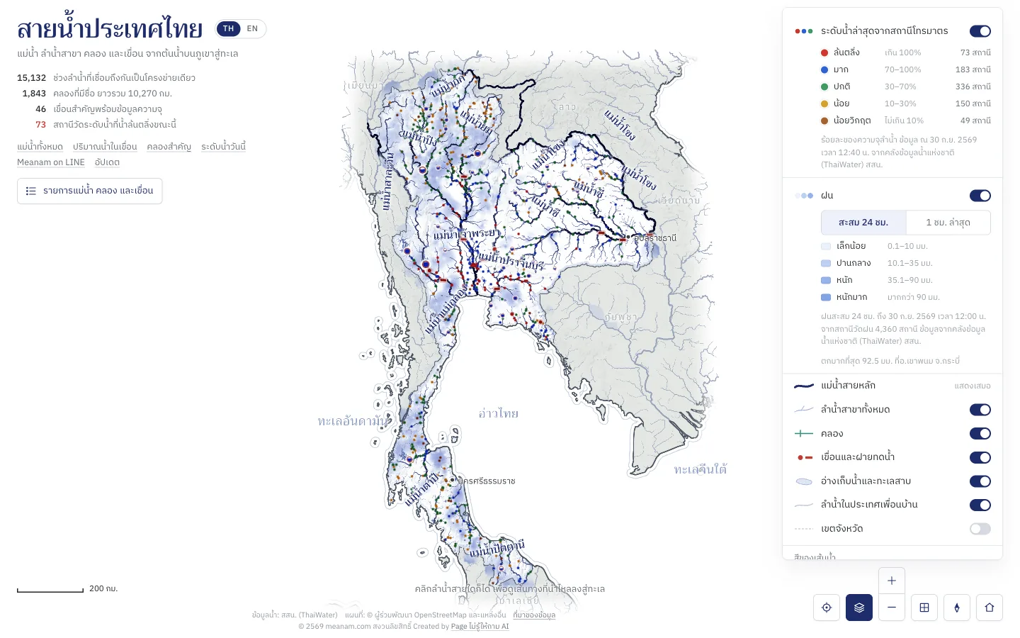
See where it rained, from more than 4,300 rain gauges across the country: the total over 24 hours, or the last hour, which is close to the rain falling now. See too how much fell on average above a dam or any point on a river, with the volume of rain that makes.
- Open the layers button on the map
- Switch on Rain and choose 24-hour total or Last hour: blue shows where it rained, deeper for more
- Tap a dam or a river to see the rain above it
Full reservoirs in red
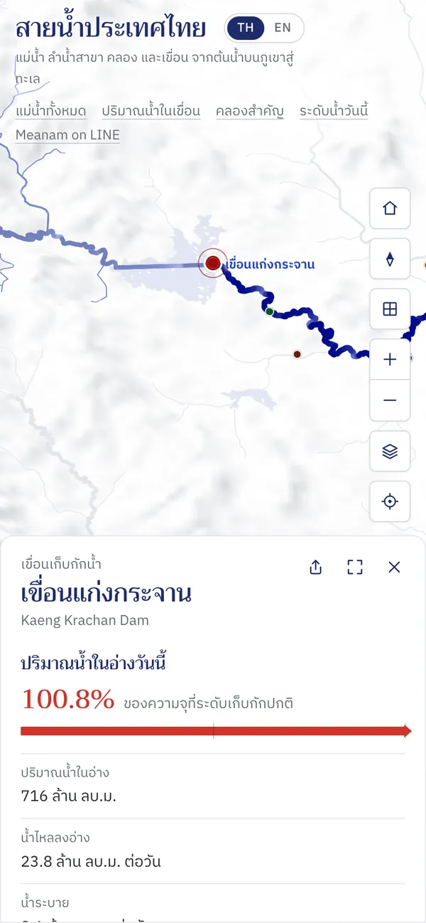
Tap a dam and today's storage comes first. Reservoirs at 100% of normal storage or more turn red, and those at 30% or less turn amber, on the map, the dam pages and in LINE.
- Tap a dam on the map
- Read the figure and the bar at the top of the panel
Meanam on LINE
Ask about water levels, dam storage and where rivers flow in a LINE chat. New friends get a welcome card, a loading sign shows while the answer is on its way, and the dams list runs from fullest to emptiest.
- Add @982juknf
- Type Dams, or a dam, province or river
- Share your location to see stations near you
Dams

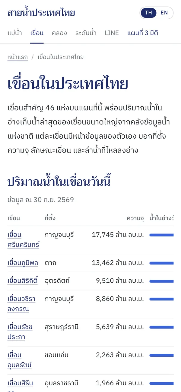
Large dams today
Tap a dam for details
Pasak Jolasid Dam
Kaeng Krachan Dam
Vajiralongkorn Dam
Srinagarind Dam
Sirindhorn Dam
Sirikit Dam
Ratchaprapha Dam
Bhumibol Dam
Bang Lang Dam
Ubol Ratana Dam
Data for 30 Sep 2026 from HII (ThaiWater)
Also improved
- Figures on the site now refresh within 10 minutes, the same as in LINE
- Pages load faster when many people visit at once
Share a place with its own preview
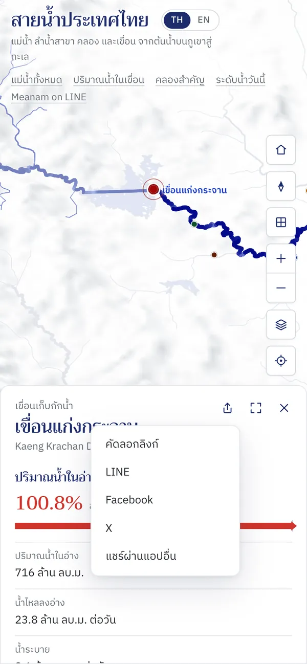
Every river, dam, station and point on a river has its own link. Shared to LINE or Facebook, it shows a preview of that place with today's figures.
- Pick a river, dam or station on the map
- Press the share button at the top of the panel
- Choose LINE, Facebook, X or copy the link
Near me
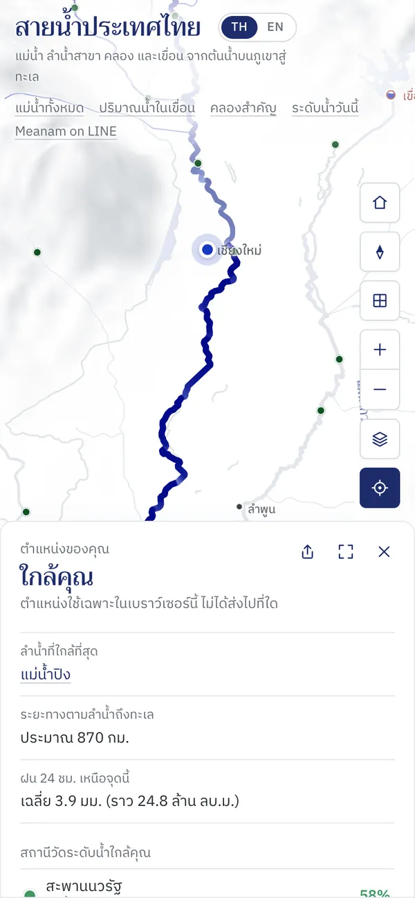
See the nearest waterway and where its water goes, with the five nearest gauging stations and three nearest dams. Your location stays in your browser.
- Press the location button on the map
- Allow the browser to use your location
- Read what is near you in the panel
Guides to rivers, dams, canals and today's levels
Read about 79 rivers, 46 dams and the main canals, with tables, small maps and common questions. On phones the menu is a single row of tabs.
- Pick rivers, dams, canals or levels from the menu
- Tap a name in a table for its own page
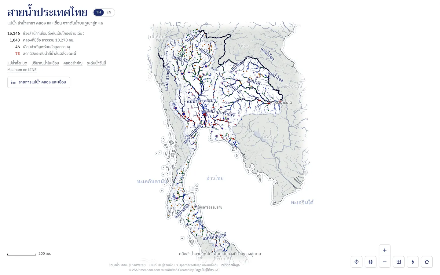
The 3D map of Thailand's rivers
The whole river network flowing from the mountains to the sea, water levels from over 800 telemetry stations and dam storage, in Thai and English.
- Click any river to see its way to the sea
- Press follow the water to fly along it
- Switch language with TH/EN
Also improved
- Canal water is traced along connected canals to a river or the sea
- Stations, dams and towns sit at their true positions