Updated
Share rivers, dams and gauging stations with a preview
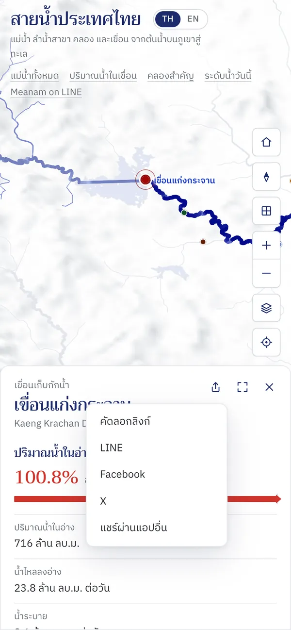
Every river, dam, gauging station and point on a river has its own link. Sent to LINE or Facebook, it shows a preview of that place with its name, today's figures and the way its water goes to the sea, and opens the map with the place already selected.
How to use it
Pick the place
Tap a river, dam or station on the map, or find it in the list of rivers, canals and dams. Its panel opens.
Press share
The share button sits at the top of the panel, next to expand and close. Every river, dam and canal page has one too.
Choose where to send it
LINE, Facebook, X, or copy the link. On phones you can also share through any other app.
Good to know
- What the preview shows
- For a dam, today's storage; for a station, the level against its bank; for a river, its way to the sea. Previews are redrawn from the data every 10 minutes.
- Where the link opens
- On the map, zoomed to the shared place with its panel open, in Thai or English.
Where the data comes from
Figures in the previews come from the National Hydroinformatics Data Center (ThaiWater), the same data as the map.
Frequently asked questions
- Why doesn't the preview in LINE or Facebook update?
- Those apps keep a link's preview for a while after it is first shared, which is why each preview carries the date of its data.
- Can I share my own location?
- Sharing from the near-me panel sends only the nearest point on a waterway, never your coordinates.